
Weather
Brownfield Ag Weather Today
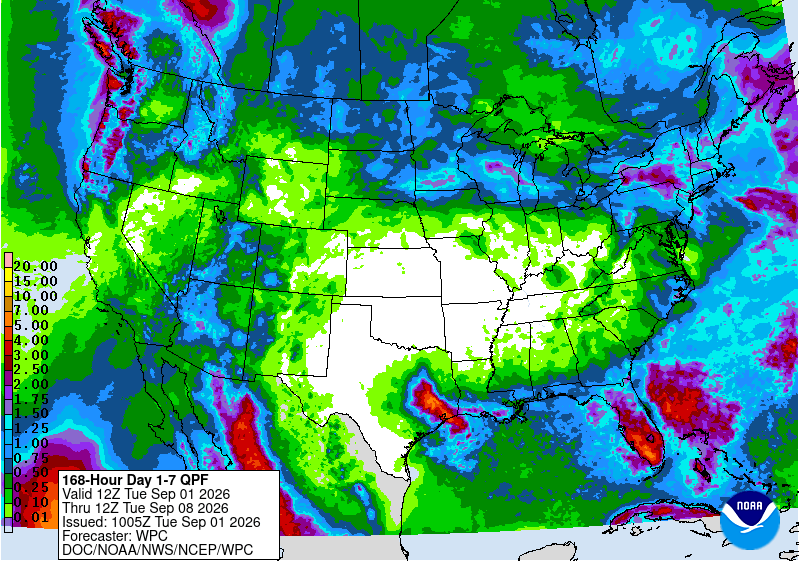
A classic “ring of fire” pattern will remain in place across the U.S., with rainfall wrapping around a ridge of high pressure (and unusual heat) centered over the mid-South. To the west, a lull in widespread shower activity will be short-lived, as several factors—including an approaching cold front and moisture drawn from Tropical Storm Marie into the North American monsoon circulation—result in widespread, late-week Western precipitation. To the north, cold fronts interacting with monsoon moisture will spark scattered showers and locally severe thunderstorms from the northern Plains into the Northeast. To the east, scattered showers will continue in the middle and southern Atlantic States, especially across Florida’s peninsula. And, to the south, the ridge of high pressure will steer Tropical Storm Edouard into eastern Texas, with flash flooding possible before dissipation occurs around the middle of the week.
Add Comment