
Weather
Late-season heat wave covers much of the Heartland; scattered showers & t-storms (locally heavy) for some
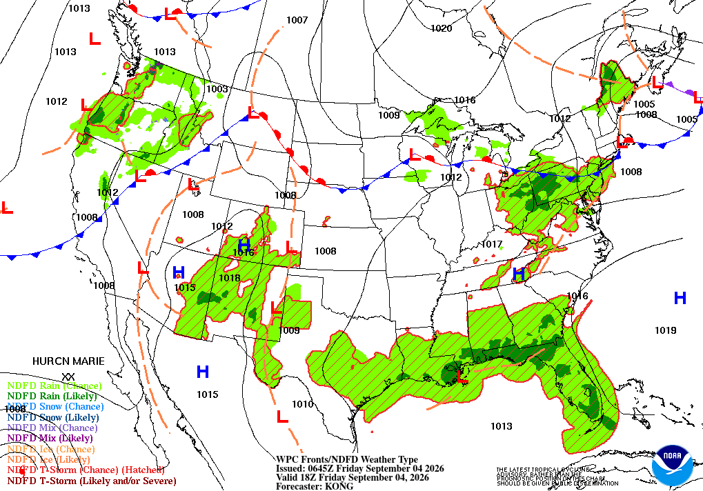
Across the Corn Belt, a thunderstorm cluster is producing heavy rain and localized wind damage in the Great Lakes region. As the day progresses, the threat of severe weather will shift southeastward. Elsewhere, hot, dry weather favors summer crop maturation, with Friday’s high temperatures expected to approach or reach 100°F as far north as central Illinois.
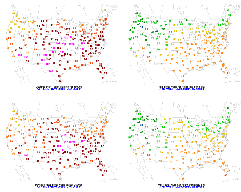
On the Plains, hot weather prevails, with Friday’s high temperatures expected to top 95°F as far north as southeastern Montana. Hot weather on the northern Plains favors late-season harvest efforts for crops such as barley and spring wheat. Meanwhile, triple-digit (100-degree) readings will occur Friday afternoon across portions of the central and southern Plains, maintaining stress on rangeland, pastures, livestock, and immature summer crops.
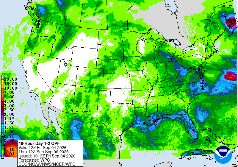
In the South, unsettled, showery weather is mostly limited to areas along and near the Gulf Coast. However, the middle Atlantic States, including Virginia, have been contending with daily thunderstorms, and will likely experience severe weather again this afternoon. In contrast, hot, dry weather across most of the region favors summer crop maturation and harvesting—but is further reducing topsoil moisture and surface water supplies.
In the West, cool weather prevails in California, the Great Basin, and the Northwest. Additionally, generally beneficial showers have developed in the Northwest, extending as far south as northern California and the northern Great Basin, although flash flooding and debris flows could occur on burn-scarred hillsides.
Add Comment