Weather
A stormy pattern to impact much of the Heartland
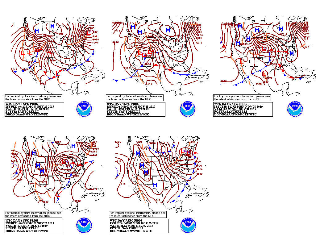
An active weather pattern will become established as the week progresses, limiting late-season fieldwork in many areas and potentially disrupting holiday travel.
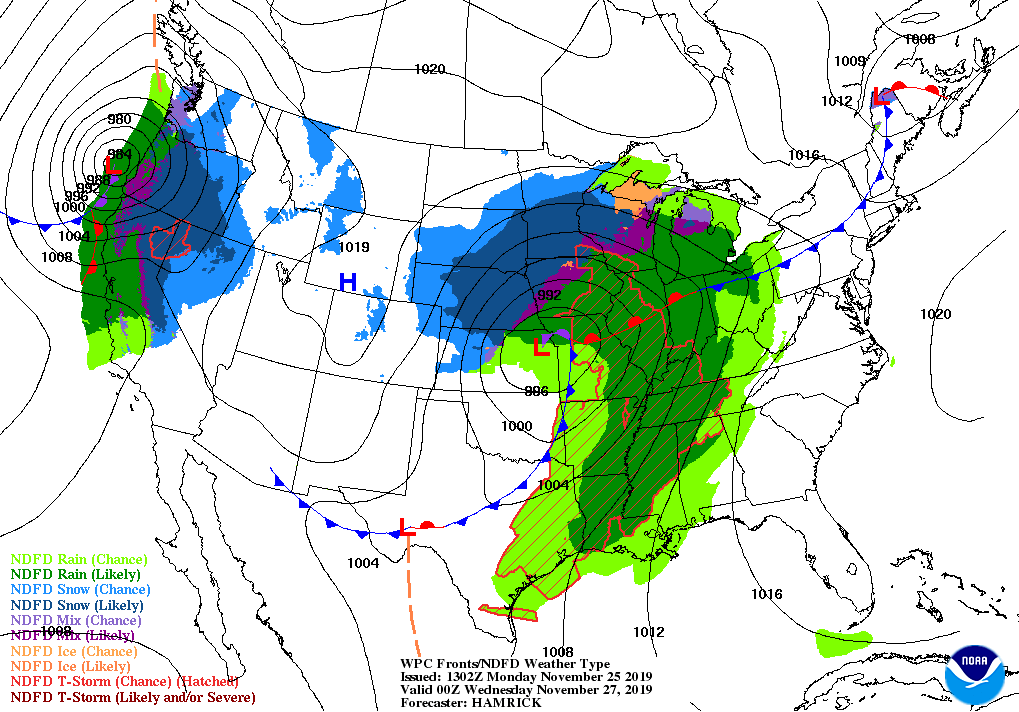
The first in a series of storms will cross central sections of the Rockies and Plains on Tuesday and reach the Great Lakes region by mid-week. Wind-driven snow can be expected on November 26-27 from the central Rockies into the upper Great Lakes region, while high winds will lead to an elevated risk of rapidly spreading grassfires across the southern Plains.
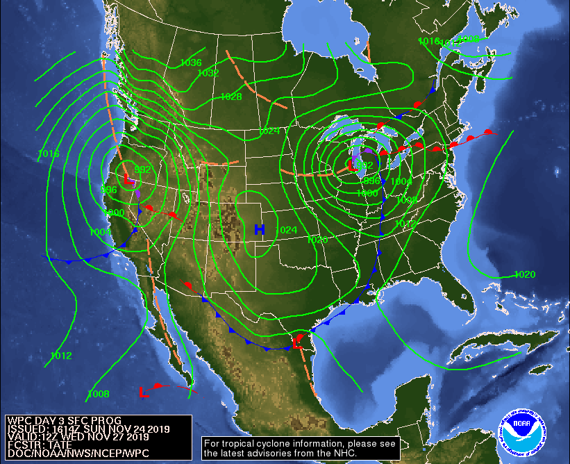
Meanwhile, a second storm system will arrive along the Pacific Coast, bearing heavy, mid-week precipitation and high winds.
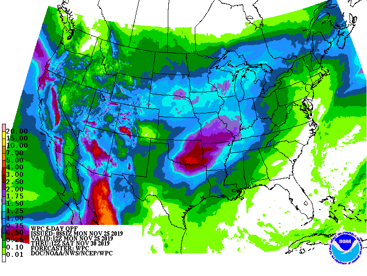
The second storm, about 3 days behind the first system, will also be responsible for heavy precipitation in the Southwest. Late in the week, snow should return across portions of the northern and central Plains, while showers and thunderstorms may occur farther south and east.
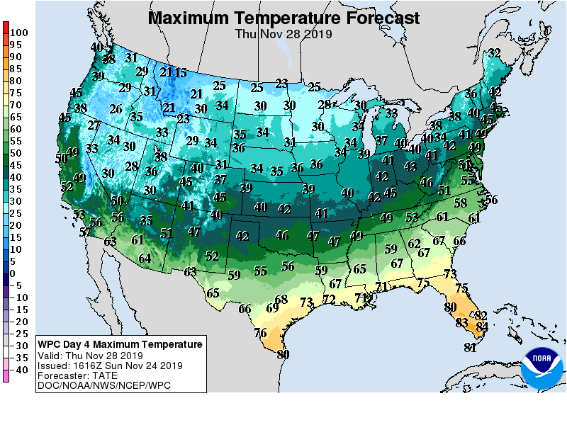
Throughout the western and central U.S., blasts of cold air will trail both storm systems.
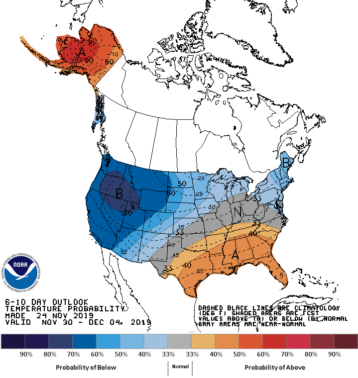
Looking ahead, the 6- to 10-day outlook calls for the likelihood of above-normal temperatures across the South, while colder-than-normal conditions will dominate the northern and western U.S.
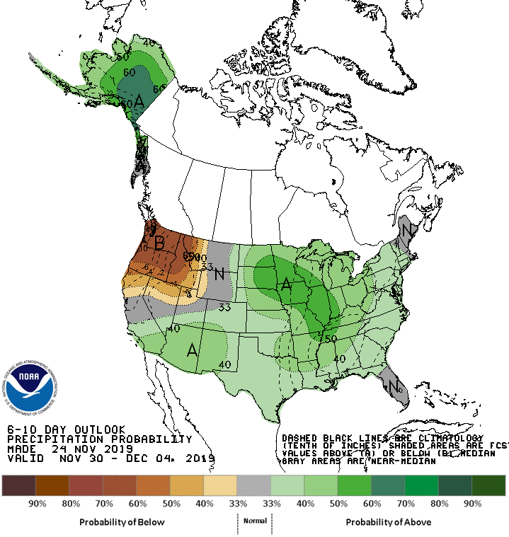
Meanwhile, above-normal precipitation across most of the country, including the Plains, Midwest, and Southwest, should contrast with drier-than-normal weather in the Northwest.
Add Comment