
News
Tropical systems may impact harvest weather outlook
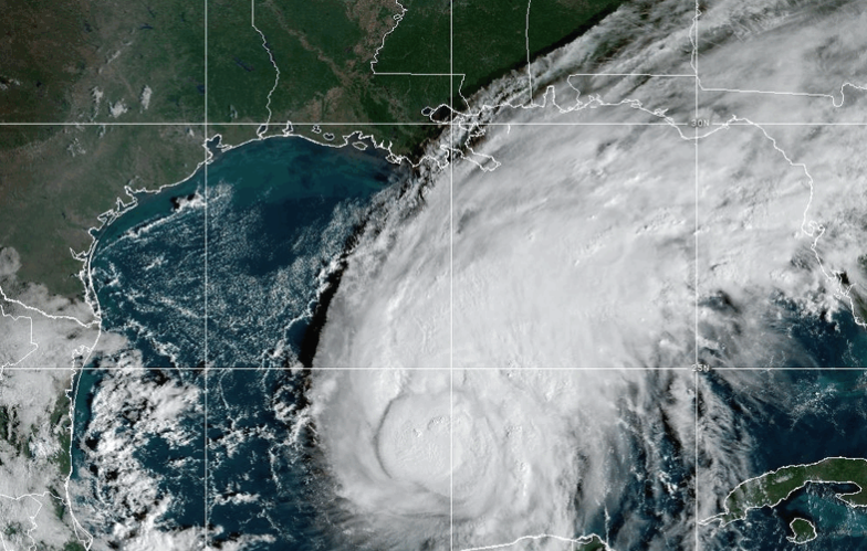
An ag meteorologist says he’s monitoring some hurricane activity that could impact upcoming weather conditions for Midwestern farmers.
Drew Lerner, senior agricultural meteorologist with World Weather Incorporated, says Hurricane Isaias is moving through the Gulf of America and could bring additional rainfall to parts of the Eastern Corn Belt after making landfall.
“The remnants will drift through the Ohio River Valley,” he said. “We will see rain totals up in that area probably running from maybe a half inch to two inches, maybe something a little bit greater in Kentucky and southern Ohio.”
He tells Brownfield Tropical Storms Rachel and Simon are tracking through the eastern Pacific and could eventually send moisture into portions of the Upper Midwest next week.
“The models are trying to develop a strong storm in the Upper Midwest and/or the Northeastern U.S. Plains,” Lerner said. “I have to admit though that I don’t have a lot of confidence at the moment, but there is that potential because there is quite a pool of cool air that is over the western parts of Canada.”
Lerner says the best chance for rainfall appears to be sometime between Tuesday and Thursday of next week.
Drew Lerner:
Add Comment