Weather
Warm; spotty to scattered rains continue to favor the Plains, western Corn Belt
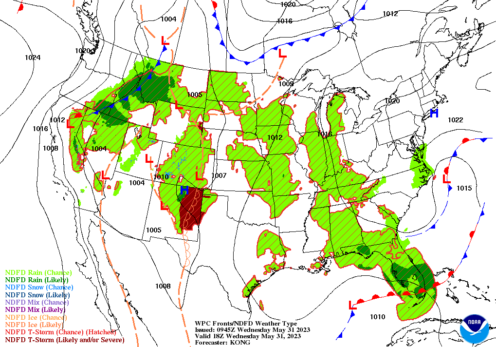
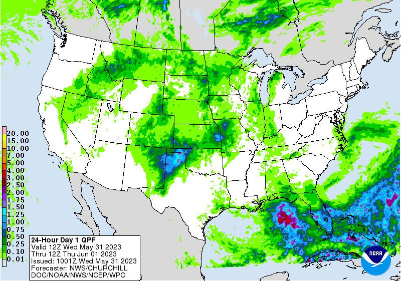
Across the Corn Belt, scattered showers are confined to the upper Midwest. Elsewhere, sudden warmth and ongoing dry conditions are reducing topsoil moisture for corn and soybean emergence and development. Wednesday’s high temperatures will reach 85°F or higher throughout the Corn Belt, with a few locations attaining 90°F.
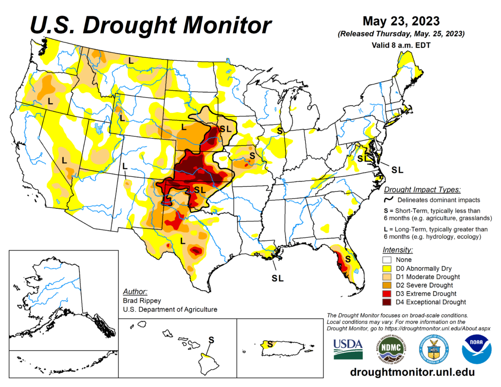
On the Plains, warmth—with Wednesday’s high temperatures generally ranging from 80 to 90°F—is promoting a rapid pace of crop development. Meanwhile, showers continue to gradually reduce drought coverage and intensity. By May 23, according to the U.S. Drought Monitor, extreme to exceptional drought still covered nearly 60% of Kansas, along with 25% of Oklahoma, 19% of Nebraska, and 8% of Texas.
In the South, lingering clouds and a few showers are confined to the middle Atlantic States. Elsewhere, mild, dry weather favors winter wheat maturation, pasture growth, and summer crop development. Wednesday’s high temperatures will reach or exceed 90°F in several locations, mainly across Florida and from the western Gulf Coast region to the Mississippi Delta.
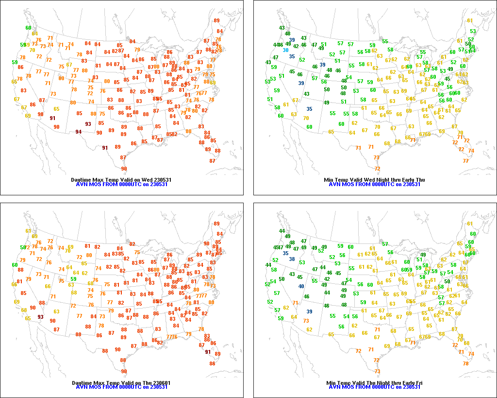
In the West, cool weather is generally confined to areas along and near the Pacific Coast. Above-normal temperatures cover much of the remainder of the West, with Tuesday’s highs expected to approach or reach 100°F in parts of the Desert Southwest. Dry weather has returned across much of the region, although spotty showers linger across the northern Intermountain West.
Add Comment