Weather
Widespread rains across the eastern Corn Belt

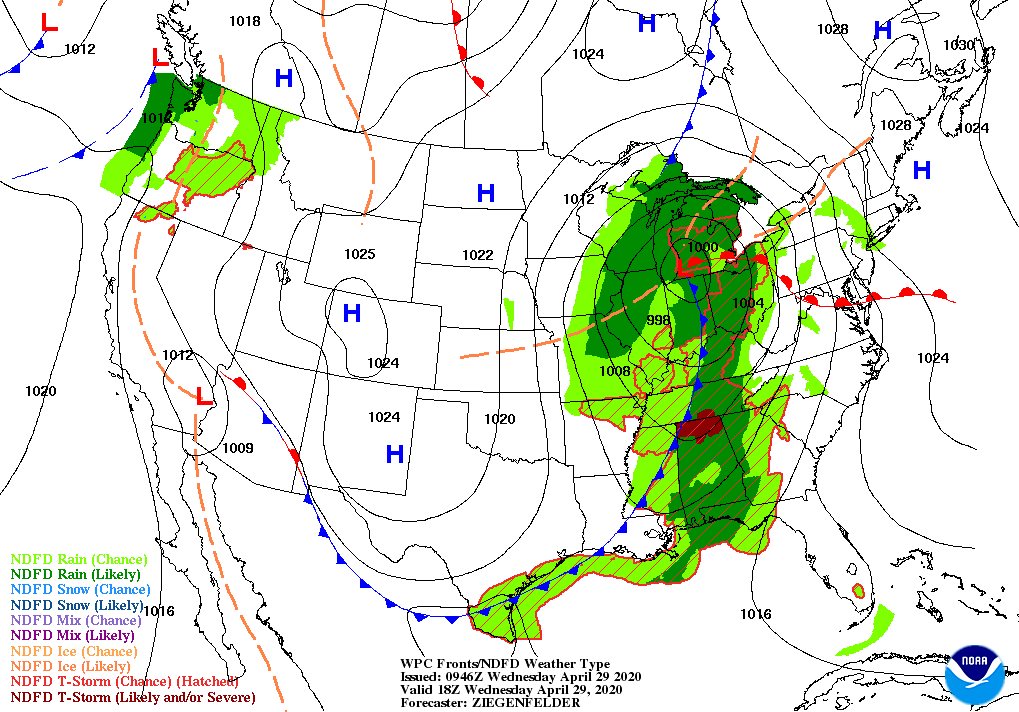
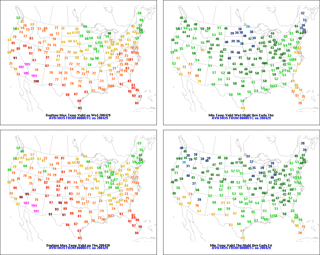
Across the Corn Belt, a significant rainfall event is underway east of the Mississippi River. Early Wednesday, some of the heaviest rain is falling from Illinois into Michigan. Meanwhile, cool, breezy, mostly dry weather prevails in the western Corn Belt, where Wednesday morning’s low temperatures generally ranged from 40 to 50°.

On the Plains, dry weather in the wake of a departing cold front favors spring fieldwork. Freezes occurred early Wednesday across portions of the High Plains, including an area stretching from western North Dakota to eastern Wyoming and western Nebraska. However, above-normal temperatures overspreading Montana are signaling a transition toward a warmer weather pattern.

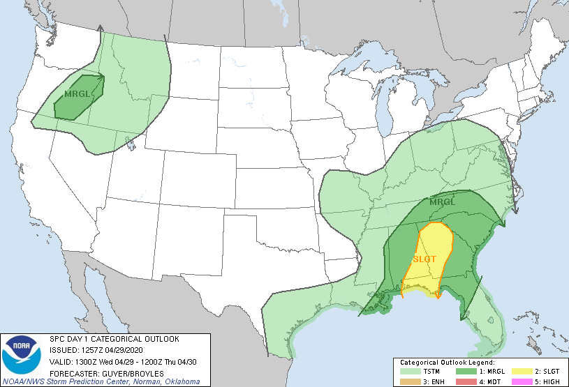
In the South, strong thunderstorms are occurring early Wednesday in portions of the western and central Gulf Coast States. Farther inland, wet conditions persist in many areas, following last week’s heavy rain. On April 26, statewide topsoil moisture rated surplus ranged from 44 to 55% in Alabama, Arkansas, Georgia, Mississippi, and Tennessee.

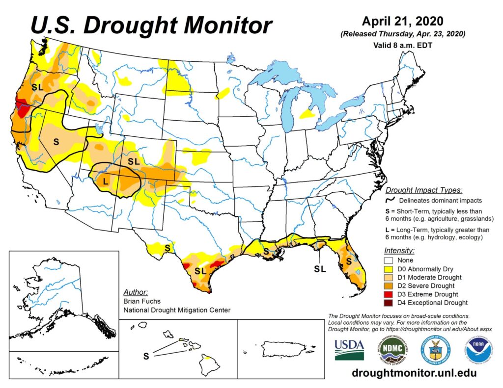
In the West, an early-season warm spell continues. In the Desert Southwest, Yuma, Arizona, reported five consecutive 100-degree readings from April 24-28—the earliest such streak in that location since late-April 1992. In general, the warmth favors fieldwork and crop development, although drought remains a concern in several areas. On April 26, Washington led the Far West with topsoil moisture rated 47% very short to short, followed by Oregon (43%).

Add Comment