Weather
Anything but January-like weather across the Midwest
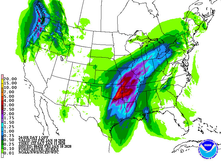
Across the Corn Belt, a significant rainfall event is underway across the lower Midwest, including the Ohio Valley. Fields are already wet across much of the eastern Corn Belt, with topsoil moisture at the end of December rated 56% surplus in Michigan and 47% surplus in Ohio. Meanwhile, the leading edge of colder air is arriving across the upper Midwest.

On the Plains, a few thunderstorms have developed in the vicinity of a strong cold front draped across Kansas, Oklahoma, and Texas. Warmth lingers across the southeastern Plains, but cold air is engulfing the remainder of the nation’s midsection. Some snow is falling across the northern half of the Plains, primarily across Nebraska and South Dakota.
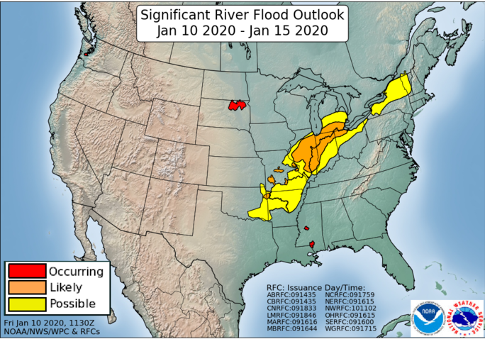
In the South, unusually warm weather prevails. However, rain continues to develop and intensity across the mid-South, while widely scattered showers dot the Southeast. Given already saturated soils in parts of the South, particularly in the lower Mississippi Valley and environs, lowland flooding is becoming a major concern.
In the West, snow showers are occurring across the southern Rockies as colder air arrives. Dry weather prevails elsewhere, except in the Northwest, where a new Pacific storm system is resulting in rain, snow, and wind.
Add Comment