Weather
Milder pattern taking hold of the Heartland
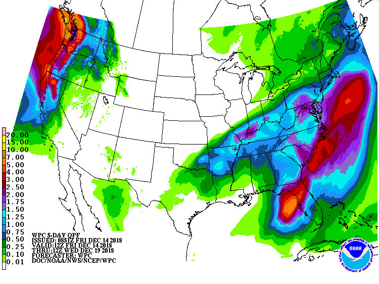 Heavy rain associated with a slow-moving storm system will fall across the middle and southern Atlantic States into the weekend, totaling 1 to 3 inches or more. Heavy rain will also fall in parts of the mid-South and the Ohio Valley.
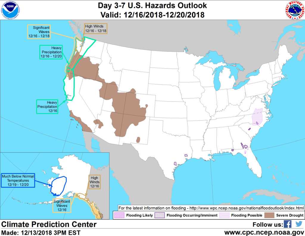 In contrast, dry weather will prevail during the next 5 days across the Plains, Southwest, and upper Midwest.
 Meanwhile, a trio of cold fronts will deliver periods of heavy precipitation to northern California and the Pacific Northwest. Most areas of the country will experience above-normal temperatures during the next few days, particularly across the northern and central Plains and the Midwest.
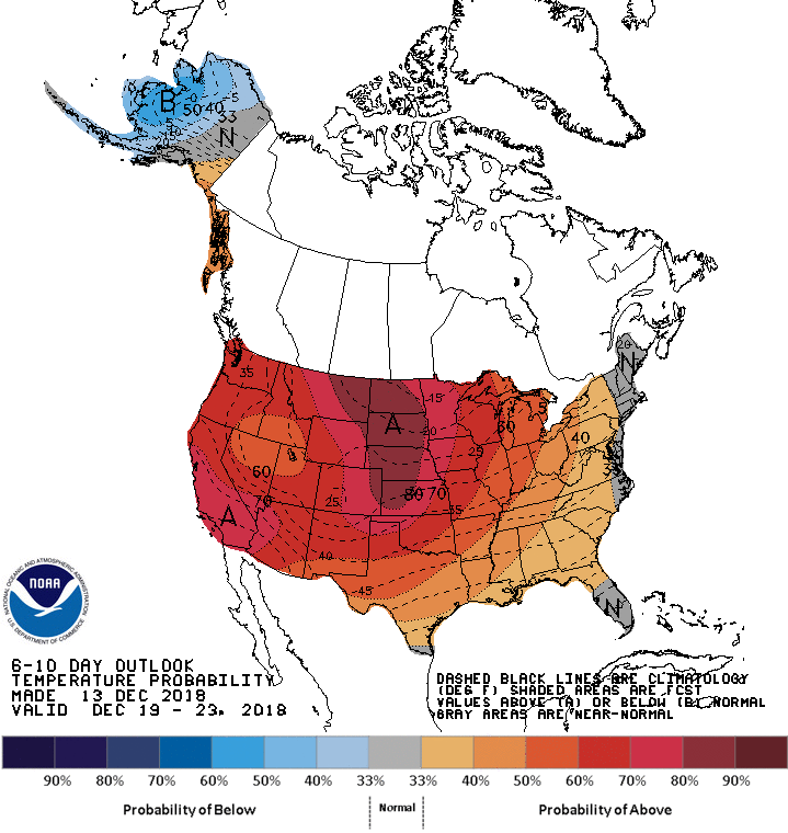 Looking ahead, the 6- to 10-day outlook calls for the likelihood of warmer-than-normal weather nationwide, except for near-normal temperatures in New England, southern Florida, and along the Mid-Atlantic Coast. Meanwhile, near- to below-normal precipitation in most areas of the country should contrast with wetter-than-normal conditions in southern Florida, southern and western sections of Texas, and across portions of the nation’s northern tier.
Add Comment